Learn more about the archaeological sites in the regions of the Orkhon and Khanui river valleys, Central Mongolia.
 © Uni Bonn
© Uni Bonn
The Orkhon Valley
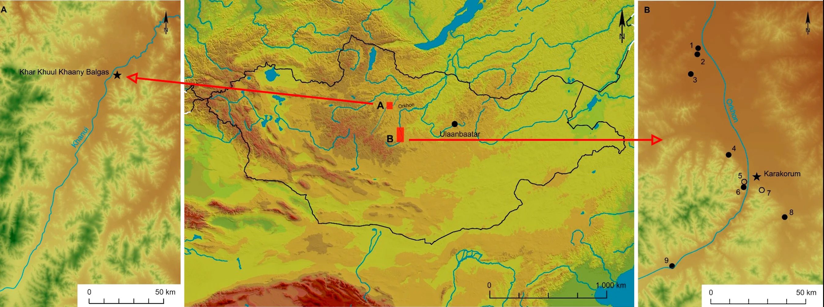
The Orkhon Valley in Central Mongolia is the main working area of our research group. The valley has been the political centre for a number of nomadic empires throughout history. The region forms part of the Eurasian Steppe belt and is characterised by grass lands in the river valley with forests of mostly Siberian Larch in the upper hills and montane areas.
The middle Orkhon valley stretches between Karakorum in the south and lake Ögii Nuur to the north. The Orkhon valley has been listed as UNESCO World Heritage Cultural Landscape since 2004.
Karakorum
Founded by the infamous Chinggis Khan in 1220, Karakorum served as a capital of the growing Mongol World Empire until 1260. After the city lost this status, it kept political and ideological significance. The city declined in the early 15th century. Since 1999, Karakorum has been the primary focus of research by the Department of Prehistory and Early Historical Archaeology of Bonn University and it also served as the starting point for the research group: How was it possible to build and nourish this urban site within a steppe environment and what was the impact of this large agglomeration of people on the environment?
Learn more about our research at Karakorum here:
Bayan Gol
Situated about 13 km northwest of Karakorum, the Bayan Gol valley is spotted with burial monuments and traces of settlement activity from prehistoric times to the modern day. The mouth of the valley which opens to the open plains of the Orkhon valley, is covered with the remains of a fixed habitation site of building platforms, partially enclosed with low ramparts, and agricultural field plots. Surface collections through systematic intensive pedestrian surveys by Bonn University from 2017 to 2019 indicate that the settlement had been used during the Mongol period.

Recently discovered on the left bank of the Orkhon valley and about 50 km northwest of Karakorum, Sarlag Tolgoi is a fixed habitation site. Momentarily only dated through surface collections of pottery sherds to the Mongol period, the research group will erudite the settlement’s chronological setting and its function within the network of sites around Karakorum. In geographic terms, the site is closely connected to Ögödei’s spring palace, identified with a building complex on Doit hill, only 8 km to the southsouthwest.
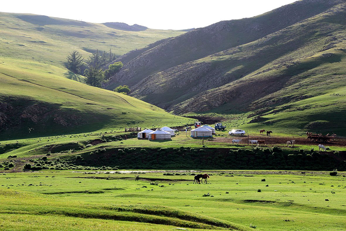
The Khanui Valley
While the environmental conditions of the Khanui valley are very similar to those of the Orkhon valley, our primary working area, its cultural heritage and history are strikingly different. The Khanui valley is known for its monumental graves from the late Bronze Age, so-called Khirigsuurs, but less so for its political importance for the historical nomadic empires. Khar Khul Khaany Balgas, a fixed habitation site contemporary with Karakorum, marks an important exception.
Khar Khul Khaany Balgas
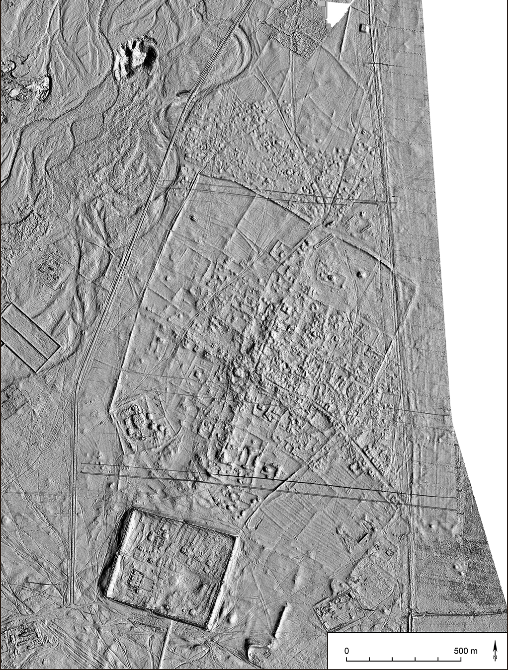
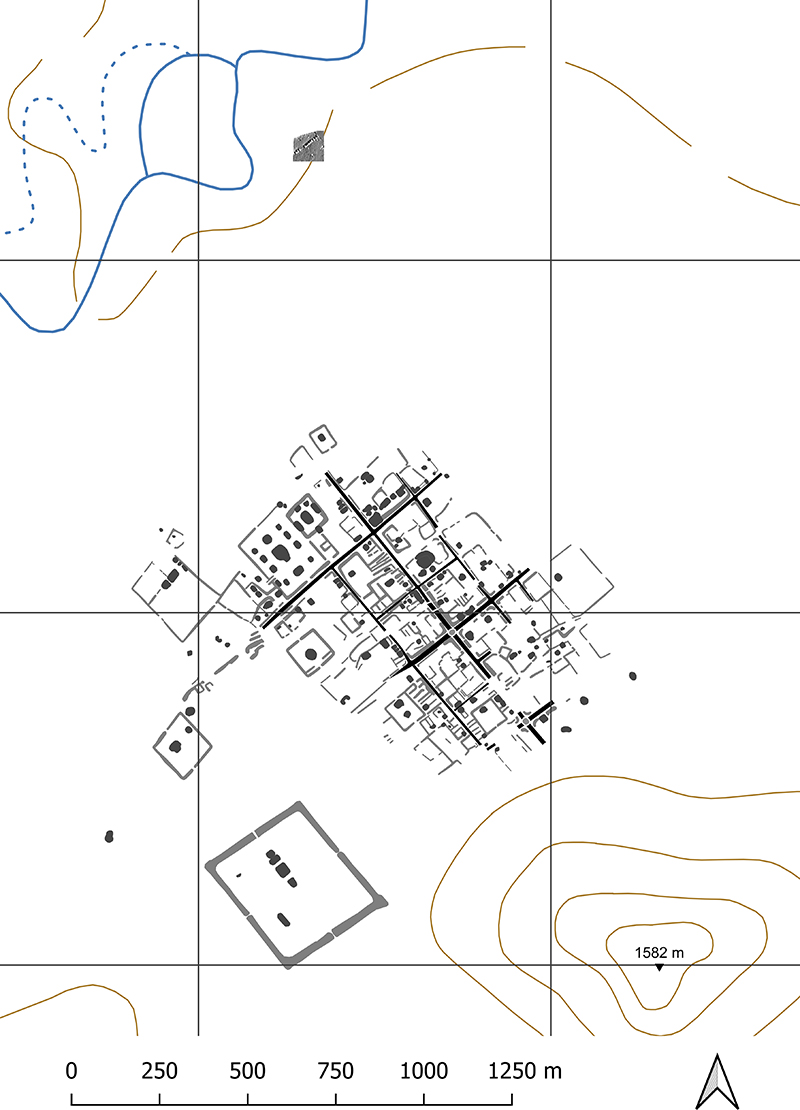
This site, also identified as Ulaan Kherem – the Red Fortress – thanks to the reddish glow of the standing walls of its citadel in sunshine, has long been known in research. However, until Bonn University started pedestrian surveys and renewed mapping of the site with remote sensing (UAV and geophysical survey) in 2017, archaeological works were few and far between. Currently, the site is being submitted to excavations by a Mongolian team headed by N.-O. Erdene-Ochir, Mongolian Academy of Sciences.
The city from the Mongol period stretches on a plain along the Khanui river and is characterised by a regular street grid with housing constructions and larger compounds, each enclosed by a rampart, around the edges. The southern area is dominated by the citadel with its four gates built from dry stone masonry. Our earlier work at the site revealed a large battery of kilns, used for firing building material.
Learn more about our previous work at Khar Khul Khaany Balgas here
back to top