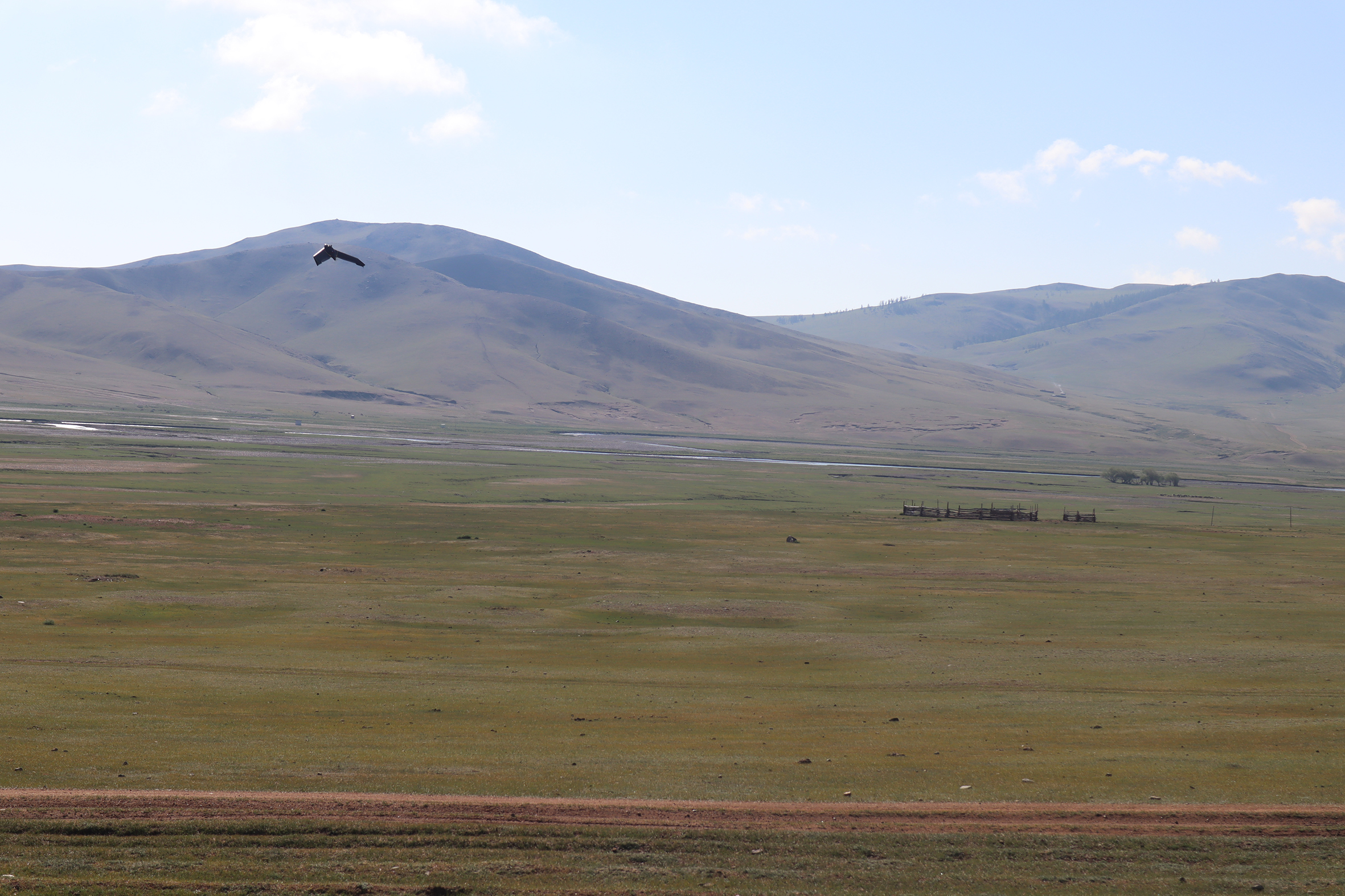
SP1 – Settlement system and economic practices in the Orkhon Valley during the Mongol Empire
SP2 – Households and demography at the time of the Mongol Empire – Comparing two valleys of Central Mongolia

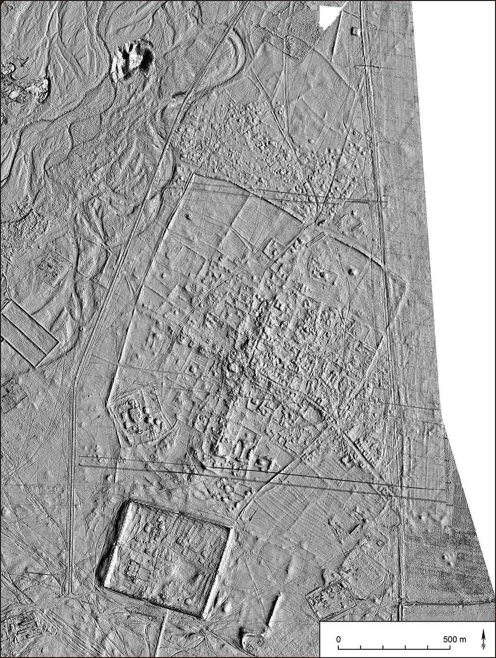
SP3 – Lang Virtual Landscape and Multispectral Survey
SP4 – Large-area magnetic mapping and source reconstruction applying a novel multichannel optical magnetometer instrument
SP5 – Geochemical fingerprints of land use and fire regimes in the central Mongolian steppe
SP6 – Bioarchaeological studies on lifeways, diet and health of the people in the Mongol Empire
SP7 – Animal use, husbandry, and herd management in the Mongol Empire
SP8 – Palaeoecology and Palaeoclimatology of the Mongolian Plateau and their impact on urbanism
During the reign of Ögödei (1229-1241), the successor of Genghis Khan, the Mongolian Empire entered a phase of consolidation. In 1235, he had Karakorum expanded as the capital and settled craftsmen and administrative specialists in the city. Envoys, tributes and loot reached the city, and there are repeated reports of the bulging treasure houses next to the ruler's palace. The available data from written sources and archaeology indicates that the city of Karakorum, the residences and the settlements were built within a period of only four years (1235-1238) under Ögödei Khan. Creating an urban landscape from scratch in a region without any existing cities is a masterpiece and has not been recognized as such until now. The valley must have been quickly transformed from a pastoral economy with low density of campsites and population into an urban landscape organized by the empire with corresponding radical changes in settlement patterns, land use, and composition of the population.
The sudden need of additional energy and also of other resources must have been a challenge for nature and man. Taking all indications together there must have been an enormous urban impact on the environment. This project aims at studying all known settlements with non-movable architecture of the Mongol empire in the middle Orkhon Valley. In close cooperation with SP3 and SP4 this project will produce precise magnetic and topographic maps of all the sites in question. In addition, two activities that are central for the verification of the theses of the Research Unit will be recorded: Agriculture and iron smelting. A classification and dating of field systems will be established. Several surveys will be conducted to localize iron smelting sites in the region. We assume that primarily wood respectively charcoal was used as fuel, so that the abruptly increased demand can be captured in the environmental archives.
Principal Investigator
Team
Prof. Dr. Dr. h.c. Jan Bemmann
Leonie Becker,
Student Assistant
This project will approach these questions through
1) systematic pedestrian survey around satellite settlements and residences north of Karakorum with a focus on the identification of resource sites,
2) excavations in different localities outside Karakorum to uncover a variety of households and to establish the settlements’ timelines,
as well as
3) excavations in a kiln site for the production of probably ceramic building materials.
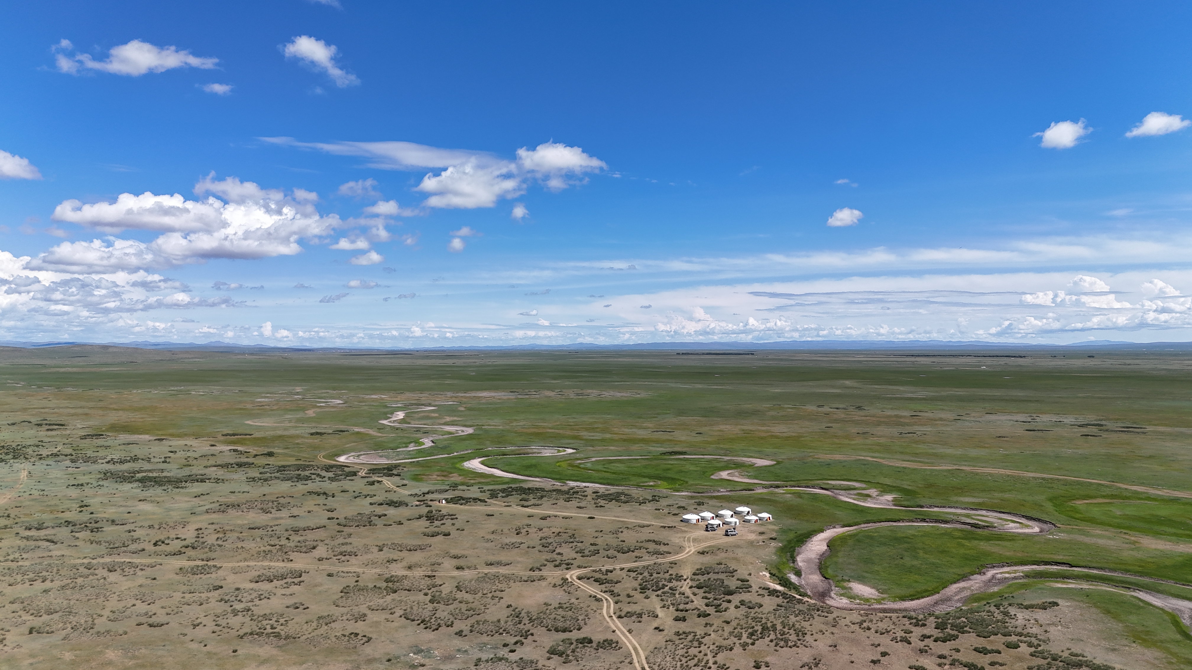
Common notions of ecological foundations deemed necessary for the survival of cities would negate the very existence of such sites in the eastern steppes. While we know where the people lived in broad, geographical terms, we do neither know how they lived nor how many they were. To ascertain people’s impact on their environment, we first need to arrive at a better understanding of their economic pursuits and scales of resource exploitation from their surroundings. Recent surveys by University of Bonn helped to shed light on the distribution of settlement sites around Karakorum themselves, but we have only limited information of individual houses and their inhabitants.
These endeavors feed into the core question of urban impacts: the goal is to get a firm grip of the economic activities of households in the Orkhon valley, of the varied uses of the landscape north of Karakorum and furthermore of those activities which come with a heavy burden on resources (wood, water, clay) and waste products (exhaust gases, ash, slags), such as metal workshops or the operation of firing kilns.
Principal Investigator
Team
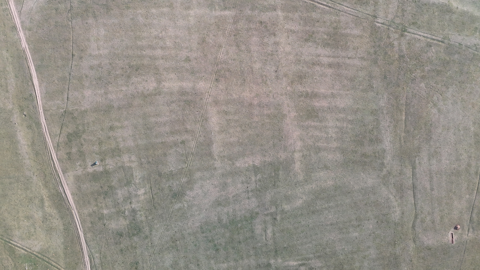
The first goal of our project is the large-scale, high-resolution and high-precision documentation of the archaeological landscape in order to provide the participating archaeologists with 3D models, orthoimages and digital surface models. For this purpose, a so-called fixed-wing drone will be used, which, with its long range and flight duration, allows the recording of areas up to one square kilometer in size in a single mission. At the same time, the areas will be imaged with a multispectral camera, which covers the near-infrared range in addition to visible light. From the resulting images, vegetation indices can be calculated that clearly show the differences in the vitality of plants. In this way, it is possible to identify subterranean archaeological structures based on vegetation characteristics that would otherwise remain hidden to the human eye.
Especially the open steppe landscape of Mongolia with its low and homogenous vegetation seems to be predestined for such an investigation. In a third step, the generated data will be compared with the results of the geophysical prospection to find out which features and structures can be best identified in which data sets and how they differ. For this purpose, an integrated GIS database system is implemented, which guarantees the integration of the data and the joint analysis. From this, a feature catalog will be developed that shows the specific archaeological structures appearing in the different datasets to serve as a basis for subsequent and comparable projects.
Principal Investigator
Team
Klicken Sie hier, um einen Text einzugeben.
The main aims of this project are:
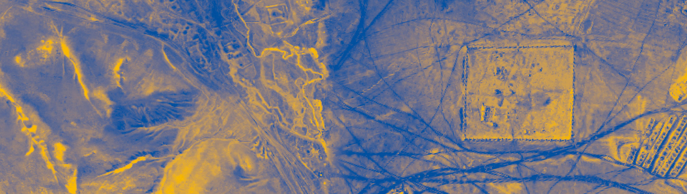
1) The development of a novel magnetic field measuring instrument for the high-resolution motorized magnetic prospection of large archaeological sites under challenging conditions, like those within the Mongolian steppe. Quantum leaps in detectability, spatial resolution and in magnetic source reconstruction capability are aimed at with the new instrument. These are based on the combination of two innovative concepts – the application of a new quantum sensor principle realized with integrated optically pumped magnetometers (OPMs) and a multi-sensor arrangement incorporating the applicant’s patented vertical sensor setup.
2) Intensive geophysical application of the new instrument to the large-area study sites of the research group. High-resolution magnetic and topographic mapping of a total area of 400 hectares in minimum on the Mongolian plateau, which will help to identify and precisely localize archaeological and geological structures hidden in the steppe ground.
3) Exploiting the recorded information-rich 3D magnetic data sets of the new instrument and including data from the other sub-projects within joint and multi-modal approaches, a new quality of magnetic source reconstruction, classification and interpretation of buried archaeological remains is aspired.
The concept and application of the new OPM instrument is directly targeted to generate a maximum of information revealing and characterizing the settlement and environmental structures on the Mongolian plateau.
Principal Investigator
Team
Professor Dr. Wulf Amelung; Ramona Mörchen
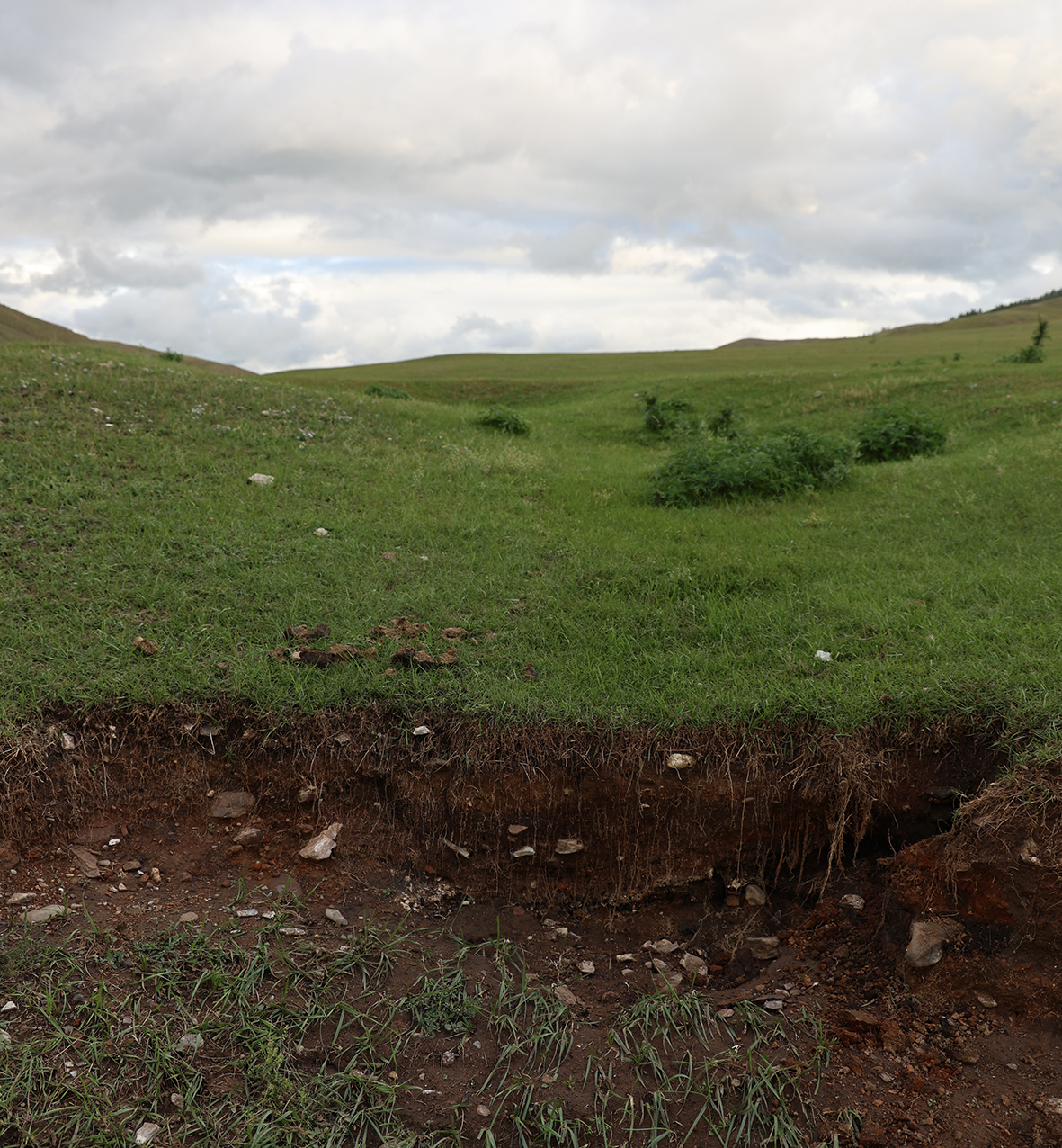
In our project we investigate the history of past land use and fire regimes in the context of paleoclimatic change and the rise and fall of the cities. At local scale, we will evaluate whether and how waste disposal differed between nomadic and urban households at specific time periods. Based on the assumption that we will find evidence for past agriculture, we will analyze colluvial deposits in order to understand regional processes. Finally, when investigating lacustrine sediment-cores, we expect to find information on how urban and non-urban phases correlate with supra-regional fire events and woody plant expansions.
To achieve these aims, we conduct nutrient, isotopic, and biomarker analyses with geochemical signals that reside in the environment over long periods of time: in order to localize organic waste, we will examine different P-forms; in addition, sterols and bile acids provide information about their origin, e.g., from humans or animals. For possible evidence of a cultivation of C4 plants, we record the stable isotope composition of soil organic matter; by lignin analyses we differentiate formerly forested and non-forested areas. Pyrogenic organic matter (PyOM) is measured with regard to BPCAs (Benzene polycarboxylic acids) and PAHs (polycyclic aromatic hydrocarbons) to reconstruct fire regimes.
Principal Investigator
Team
What impact did the new urban lifestyle and living environment have on the dietary habits and health of the inhabitants of Karakorum and the surrounding population? Thanks to recent developments in the field of archaeological science, central questions about the lifestyles of past populations can now be answered through biomolecular studies of archaeological material.
The proposed sub-project therefore aims to use stable isotopes (δ13C, δ15N and δ34S as well as δ18O, δ34S and 87Sr/86Sr) of human and animal remains from the settlements of Karakorum to gain insights into the dietary habits of the inhabitants and their geographical origin.
By combining osteological and archaeological data on sex, age, and social status, our research will reveal insights into the cities’ supply chains and examine how lifestyle and environmental changes from their founding have impacted local health. We will also explore the potential of advanced, emerging analytical techniques—including compound-specific stable isotope analysis, heavy metal residue testing, and palaeoproteomics—to deepen our understanding of these dynamics.
Our subproject has conducted multiple field campaigns in Karakorum—the former capital of the Mongol Empire—focusing on the excavation of the city’s Muslim cemetery. This work has not only clarified the layout of the burial grounds but also offered new insights into how the Islamic community may have integrated within the Mongol social structure.
Our work reveals a Medieval Islamic community's burial practices, providing a fresh perspective on their organization within Mongol society. The recovered burials serve as a unique record of a Medieval Islamic community on the Mongolian Plateau. At the same time, macroscopic analyses of the skeletons have provided a distinct perspective on the community’s members, their diseases, and lifestyles. Ongoing isotopic analyses of both the human remains and associated archaeological fauna are further enhancing our understanding of their dietary habits, geographical origins, and environmental contexts.
Principal Investigator
Team
Jun.-Prof. Dr. Alice Micaela Toso
Dr. Júlia Olivé-Busom
Postdoctoral researcher
Ruben Burkhardt
Student Assistant
s5ruburk@uni-bonn.de
The main goal of the subproject (SP) 7 is to better understand the role of animals in medieval Mongolian subsistence. Main source of information are the extensive archaeological excavations in Karakorum conducted by the University of Bonn. Although a first analysis of the faunal material revealed a diverse fauna with sheep and cattle being the main source of meat and fat, many questions are still lingering. By comparing the faunal data between different sites with potentially different past environs we intend to elucidate herd management of nomadic pastoralists during the Mongol Empire, the adaptation strategies, the provenance of livestock species and their genetic makeup. The archaeofauna from Karakorum will serve as the basis for addressing medieval animal exploitation and husbandry in central Mongolia. Additionally, novel approaches will be applied to improve our understanding of caprine management regarding foddering reflected by tooth abrasion, lamb mortality and the effects of penning of sheep in enclosures.
It is likely that supply of urban meat markets with sheep involved local and distant herds. We will test whether phenotypically distinct sheep populations shaped meat provisioning at Karakorum and the other sites using Geometric Morphometrics (GMM). Stable isotope analysis (C, O, Sr) and most of the ancient DNA work will be conducted in Phase II. One key issue is the distinction of taurine cattle, yak, and their hybrid named khainag (хайнаг). Khainag is particularly well adapted to cold, mountainous environments and it is an open question when and why people bred and/or introduced this hybrid. Our project will therefore look more closely into the osteology of this hybrid and its parents using modern references. Ancient DNA analysis of selected specimens will assist us to confirm hybrid status and detail the khainag's genetic make-up.
Principal Investigator
Team
Dr. med. vet. habil. Joris Peters
Ptolemaios Paxinos
Postdoctoral Researcher
The main goal of the project is the reconstruction of the palaeoenvironment and palaeoclimate in central Mongolia in relation to the urbanism in the Mongolian steppes. High-resolution lacustrine sediments will be used as archives for this approach. This will allow not only to investigate the special time slice related to the Mongol Empire, but also time series based on diachronic view over thousands of years to reconstruct long-term palaeoenvironmental changes. For several reasons pollen analysis is the principal method for reconstructing Quaternary terrestrial environments.
Since pollen can now usually be identified to the genus level, and frequently to the species level, there is great potential for detailed reconstruction of the vegetation in the Mongolian steppes. By applying statistical methods, pollen assemblages will be compared and used for the reconstruction of regional environmental conditions and variations in the study areas through time.
The obtained proxy data and reconstructions will contribute to integrate archaeological results with those of the palaeoecology and palaeoclimatology.
Principal Investigator
Team
back to top